Blue Loop - Pink Trail - Firetown Trail - South Trail - Horse Trail
*No ants were harmed, I promise!
Happy Trails,
~Molasses~
Blue Loop - Pink Trail - Firetown Trail - South Trail - Horse Trail 06/19/2011 8.5 Miles The first thing we ran into on our hike was the Trout pond, and on the bank of the man-made pond sits my house. Alright, alright, so it's not really my house, it was Senator George P. McLean's house until he gave it, and the land, to the towns of Simsbury and Granby. Although, as I told my husband, if he'd build me this tiny little cabin somewhere in Northern Maine, on the banks of my own pond, or lake, or even river, I'd be one happy girl spending many weeks there in the summer. :) As we continued on our hike we eventually met up with the pink trail. A little ways down the trail we were supposed to run into a Summit Trail that takes you to a 580 foot summit in the Barndoor Hills. Unfortunately, the trail we later learned was the summit trail, was un-blazed. Surprisingly enough, Sidetrack didn't seem to feel inclined to run off and explore this unmarked trail, so we continued on. 
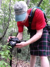
We eventually ran across an old piece of farm machinery. Now there was something worth exploring. We stopped and I took off my pack, hanging it up on a nearby tree, while Sidetrack fished out his camera and began to take a number of pictures. The machinery appeared to be an old Hay Baler. Pretty cool piece of machinery. This refuge was, at one time, 3,200 acres of Farm and Wild Land. While Sidetrack photographed the machinery I decided my backpack looked photogenic as well hanging from the tree. I was hoping the picture might come in useful somewhere in the hiking web-page I'm putting together. Yupp, no bridge at brook crossing. 
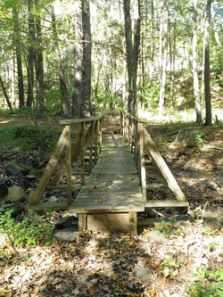
We hiked on, eventually crossing Simsbury Road, and heading down the "Firetown Trail". As we turned onto the blue-blazed "South Trail" we saw a sign that said "No Bridge Over Brook". Okay, no big deal, we reach bridge-less brook crossings and survive all the time. As we approached the brook we quickly understood why this warning was relevant enough to have a sign. This brook was deep enough that crossing with anything but high boots, and gaitors was going to mean wet feet. Wouldn't you know it, this was the first time in a long time that we hadn't bothered to bring our gaitors with us. *sigh* If we couldn't find a shallow crossing spot we'd have to remove our boots and go barefoot across. Sidetrack took off down the edge of the brook and after a minute or so he called back that he'd found a spot he thought we could cross without removing our boots. We made it safely across the brook, I ended up with only one wet ankle. We then decided we should stop for a lunch break. We sat on the edge of the brook and enjoyed our snacks while I flicked carpenter ants into the brook when they had the nerve to crawl up onto my backpack. It was entertaining to watch them swim to shore, then climb back up, then they'd climb back onto my pack and I'd send them for another swim. :) I think I could have done that all day.* :) As we sat there I also spotted, on the other side of the brook, some insects that looked like dragonflies, but had wings that flapped like a butterfly. I found myself confused, but as I pulled out my cell phone to look up what they were I found that I had absolutely no cell signal. I made a mental note to look them up when we got somewhere with signal. *No ants were harmed, I promise! Cute little mushroom. (Photo by Ahren aka Sidetrack) 
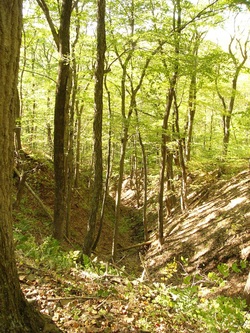
The rest of the hike was more or less uneventful. This isn't the kind of place you go if you're looking for sweeping views of the countryside. However, it is the kind of place you should go if you like pine forest, it seemed that most of the day we were walking in pine forest. It's also the kind of place you go if you like wetlands, we saw quite a number of ferns and a few swampy, marshy area's. It was also surprisingly peaceful for being in such a populated area. The only exception being that it is right in the flight path of Bradley International Airport, though I only recall hearing 2 or 3 planes during the 7 hours we spent there. As we met up with Bissell Brook again along the horse trail we saw those strange insects again, the ones that looked like dragonflies with flapping wings. Only this time they were on our side of the brook, so we got a better look at them. And this time I also had cell phone signal so I was able to learn that they were Damselflies. I'd heard of Damselflies, but never really knew what they were, and had obviously never seen them. They are gorgeous! We spent a lot of time watching the Damselflies (at least half an hour) before finishing our hike. It ended up being a really nice day. This is a very nice place to hike, I recommend it.
Happy Trails, ~Molasses~
1 Comment
Originally posted 03/14/2011 Hiked on: 03/13/2011 A little over 6 Miles For our completion of the Westwoods trails we decided to Park on Peddlers Road and take the White Circle Trail in to meet up with the Yellow Circle Trail, which we followed until we met up to the Violet Circle Trail. We then followed the Violet Circle Trail back to the Green Rectangle Trail until it met up with the Yellow Crossover Trail, which took us back to the Yellow Circle and we backtracked along it, to the White Circle and back to our car. Confusing as it sounds it made for a nice loop.
Maps of this Trail System are available in the CT Walk Book East and at the following website: http://guilfordlandtrust.org/wordpress/properties/westwoods One thing to note is that the CT Walk Book states that the Yellow Circle Trail is the most challenging trail in the Westwoods trail system and as such “is recommended only to the agile and energetic hiker”. This is no joke! Do not attempt this trail unless you are experienced, agile, energetic, and willing to get a little dirty. Now I will mention that there are bypasses around the most difficult area’s, though they are unmarked which means they are unofficial, so take caution if choosing to use them. Hikers are strongly encouraged to pick up a trail map before setting out! Now, for the fun part, pictures of our hike! Originally posted 12/29/2010 12/24/2010 Blue Circle Trail Starting at Dunk Rock Road to Green Circle Trail, then Green Rectangle Trail to Orange Circle Trail, then Red Triangle to cross over to the White Circle Trail, then we took the Green Rectangle back to Dunk Rock Road. Confused yet? Maps of this Trail System are available in the CT Walk Book East and at the following website: http://guilfordlandtrust.org/wordpress/properties/westwoods The Westwoods Trail System within the Cockaponset State Forest is a great place to get your feet wet in the world of hiking. It’s got a little taste of everything. If you stick mostly to the Rectangle, square, and triangle trails you’ll be in for pretty easy walking. If you want something more challenging check out the circle trails. Keep in mind that the Yellow Circle Trail is recommended only to experienced, agile, and energetic hikers. Based on what we saw of the White Circle trail I would heed that warning as it required some agility as well. Also, based on what we experienced of the White Circle Trail, we’re looking forward to heading back to do the Yellow Circle Trail soon. All Photo’s by Ahren Niles. (Yes, including the one he’s in, he set the camera up for the conditions, I just aimed and pushed the button.) Here’s a link to what my GPS tracked of our hike for the day. Pay no mind to the stats as they seem to be really off. There’s no way we hiked 11 miles, and there’s no way our max speed ever hit 7.83 miles/hour. Silly GPS.
Originally posted 12/02/2010 Hiked on 11/29/2010 On our second hike at Macedonia Brook State Park we took the white blazed trail up to the top of Cobble Mountain where it ends, and then we followed the blue trail back to where we had stopped on our last hike. Then back up Cobble Mountain and down via the blue trail, which we then followed up and over South Cobble Mountain and back to our car. Macedonia Brook is a beautiful park to visit any time of the year. There are lots of really nice trails that can be combined to create pretty much any length or difficulty of hike. During the summer there are also a couple of camp-grounds. Great place, highly recommended! Macedonia Brook State Park.
Originally posted 12/02/2010 Hiked on: 11/13/2010 We ended up doing this trail in two hikes. The first hike we started out on the blue trail as described in the CT Walk Book West (pg 78), but instead of hiking up Cobble Mountain we stopped at the green trail and followed it out to the Orange Trail/CCC Road which led us back to our car.
Originally Posted 11/02/2010 Route 66 - Mt. Higby - Giuffrida Park 10/31/2010 Approx. 10 Miles This trail has just undergone a major re-route, which actually was ongoing last time we had tried to hike this trail. We had managed to time our last hike here at just the wrong time. The trail re-routing was in progress but unfinished, and the CFPA website hadn’t yet been updated to mention the problem. Last time we ended up having to abandon our hike due to blazes just suddenly stopping and having to walk back to our car at our start position via roadways. The new trail map is now available on the CFPA website so we decided to revisit the trail to complete the trail properly.
We started out the morning by leaving the car at a small Trail-head parking lot along Route 66. Like many of the trails in this area you start going up pretty much immediately. After walking up for awhile and a couple rock scrambles we were re-warded with a nice view of Beseck Mountain and Black Pond, which we’ll be visiting on one of our next hikes. After waving to Beseck we continued on up Higby Mountain. One of the cool things about Higby Mountain is that it’s a very prominent feature along I-91 so ever since I’ve lived here every time we drive past it I look at it and think “I really want to be up there!” and of course, then there’s my husband who’s lived in CT his whole life and has thought that same thing every time he’s driven past it since he was a little kid. Now, finally, after all these years we were hiking up it!! A lot of times a person’s imagination makes something out to be better than it is, but in this case Higby lived up to the dream created by our imaginations, Higby was everything we’d ever hoped it would be, it was amazing to be up there. If you live in the CT area and want a great close to the edge Ridge-walk, head out to Higby. Just don’t expect a quiet vista, the highway noise is very prominent due to I-91 being right below you. We took loads of pictures, so I guess the best way to continue this is through a photo gallery… Originally Posted 11/07/2010 Beseck Ridge 5.7 Miles 11/06/2010 This hike marks the completion of the Mattabesset Trail for us, which was pretty exciting. We were going to re-visit Lamentation Mountain on this hike. Due to a trail re-route we had some confusion when we hiked Lamentation Mountain on 7/20/09. Beseck was pretty tiring though so we abandoned that idea and will be re-visiting Lamentation Mountain on our first Metacomet Trail Hike.
We’ll be mailing off the form to get our Mattabesset Trail completion patch on Monday. We may start working on the Metacomet Trail next, once we start getting snow here though we’ll shift to completing shorter loop and/or out and back trails until spring. Originally Posted 10/26/2010 Pistapaug Mountain - Trimountain - Reed Gap - Route 17 - Route 68 |
Please Note: This blog is NOT intended to be used as a trail guide. Please visit the CFPA Website for an interactive trail map or to pick up a CT Walk Book in their bookstore.
If, after reading the trail guide, you still have questions, we are happy to help where we can. Please hike responsibly, know where you're going, carry a map. Hikers in this Blog:
Molasses: as in slow as. Categories
All
Archives
October 2014
|